Fuerteventura, tour through the centre and the south
Fuerteventura. A Tour through the centre and the south of the Island
Fuerteventura is synonymous with beaches. However, the beaches here are not the kind of beaches you might know from anywhere. The miles of beaches on Fuerteventura convey the feeling of never wanting to end.
Perhaps because on Fuerteventura it is so easy to find one of those dream beaches on your own, we would like to offer you a route through the lesser-known centre of Fuerteventura. We will still see beaches; there is no other way on Fuerteventura. Our departure point is right at the beach. You might want to pay this one a short visit before we start our route through the island.
You have probably already rented your Rent a car Airport Fuerteventura with Hertz or Thrifty, or in our airport office with Dollar brand. Otherwise, you have the option of renting a car at our office in Caleta de Fuste, from where we will start.
Caleta de Fuste and Salinas del Carmen.
Caleta de Fuste is an ideal vacation spot for travellers. This popular place has grown around a natural bay that protects it from the wind and waves. That protection is rare on the island (Caleta de Fuste is therefore a perfect destination for a family vacation). You will also find an incomparable range of shops and services available. Caleta de Fuste is far away from the island's two tourist centres, Corralejo in the north and Costa Calma in the south. There are a lot of good restaurants and a lively nightlife at this lovely place. Caleta de Fuste is all you need, and more.
Do not miss the town's Paseo Maritimo (the seafront promenade) or the Castle of Caleta de Fuste, also known as Torre de San Buenaventura. As on other islands, the pirate attacks in the 18th century forced the construction of defenses on the coast of Fuerteventura (we recommend reading the itinerary of Menorca on this subject); mainly to protect the port entrances.
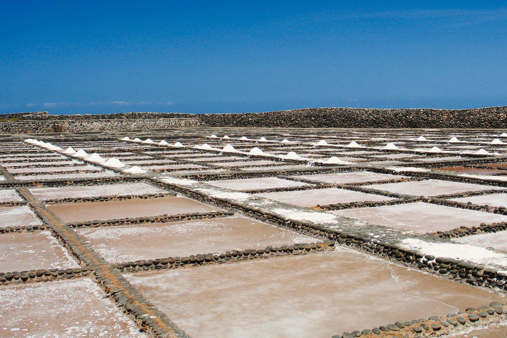
From the castle, we head south, and take the FV-2. We should definitely go to the Salinas del Carmen, the only still active salt production plant on Fuerteventura. It is only 4 kilometres away. A visit to the salt museum there is worthwhile.
Las Playitas, a lighthouse and Gran Tarajal.
We continue on the FV-2 for about 25 kilometres, and then we take the FV-4 for 3 kilometres and finally take the detour via the FV-512 to Las Playitas, a small fishing village with whitewashed houses. Nearby the village, there is a volcanic sandy beach.
Only 6 kilometres away via the FV-511 shows up the recently built Entallada lighthouse, which can boast of being the closest geographical location to Africa on the island. From there we have an impressive view over the cliffs on which the lighthouse rises at a height of 200 meters and over the natural monument Cuchillos de Vigan: a landscape that was formed by the lava flows of the Jacomar volcano.
After this little excursion we have to drive the 10 kilometres back to the FV-4 and follow this road for another 2 kilometres until we get to Gran Tarajal. Gran Tarajal is, after the capital, the most important town in the south of the island, and houses a large part of the hotel businesses without being very touristic itself; there are also many shops and service companies. Gran Tarajal is thus similar to Caleta de Fuste in terms of its diverse offer and good infrastructure. There is a beautiful seafront promenade, a trading and fishing port and a black sand beach.

La Lajita – Oasis Wildlife.
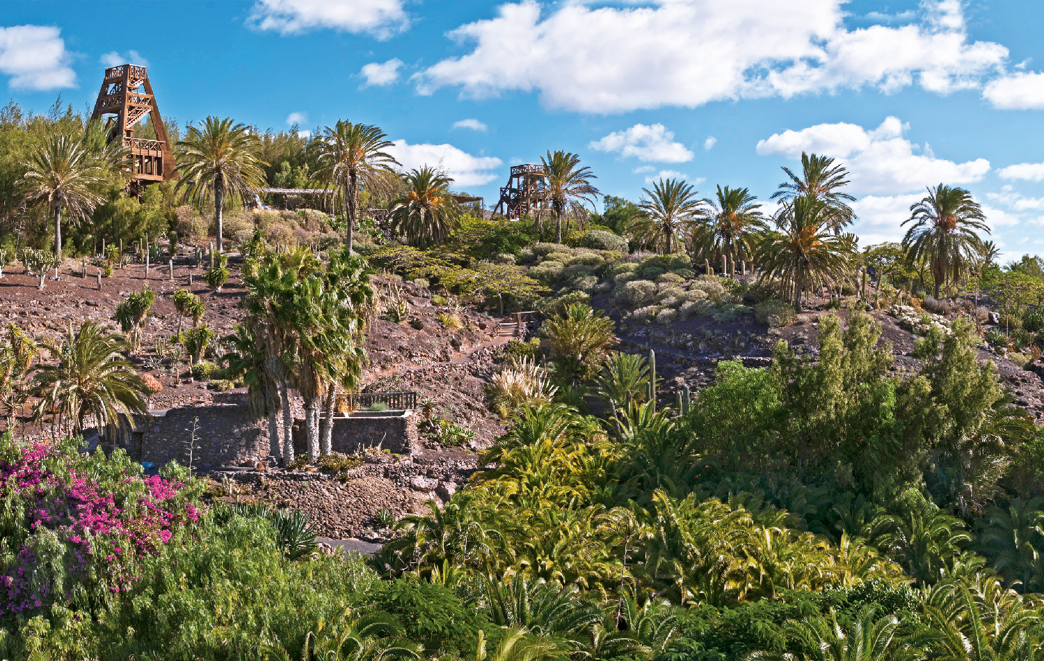
Again, we have to go back to the FV-2 and drive about 20 kilometres in south-west direction. We then would like to make you two possible suggestions, between which you might choose on your route in order not to make the tour too long. One possibility is to visit La Lajita, which has - like Las Playitas - a special attraction as a fishing village. The village is also dedicating to agriculture and cattle breeding. In recent years, it has experienced a great tourism boom due to its proximity to Costa Calma, but without losing its unaffectedness. The second option is to visit the Oasis Wildlife Zoo, which is very popular, especially for families traveling with children. The Oasis Wildlife has more than 3,000 animals of 250 different species.
La Pared.
Here we leave the leeward side of the island and cross the isthmus of La Pared to get to the windward coast of Fuerteventura. We drive the FV-2 about 6 kilometres southwest, and then take the FV-605 another 6 kilometres to the north until we finally reach the west coast of the island. These last 6 kilometres, which we drove north, run exactly over the isthmus that connects the Jandia peninsula with the rest of the island.
It is quite interesting that this region is geologically the oldest one of the island. 70 million years ago, volcanic activities took place underwater, and created the lower layers of what is now Fuerteventura. It covered immense layers of marine deposits that surfaced 50 million years later and make up the central part of the island. Only later emerged the southern and northern regions of the island.
Anyone driving across the isthmus of Jandia should be aware that this landscape previously was under water; and that it is exposed to constant erosion since its creation, until it got today's appearance.
Ajuy and Pájara.
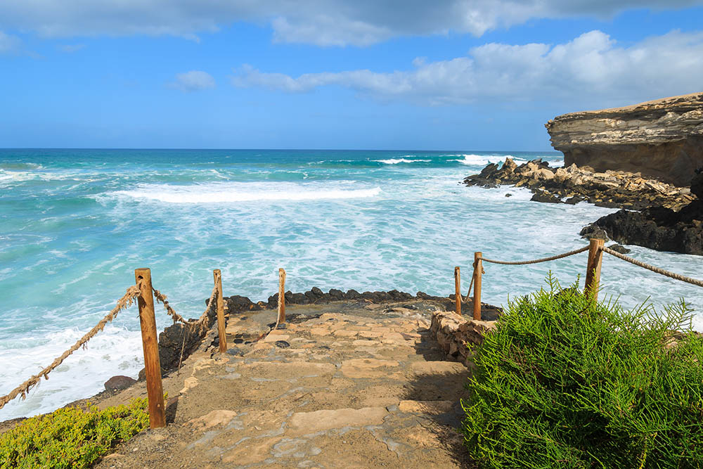
Ajuy is a small coastal village that lives mainly from fishing. Similar to the fishing villages mentioned above, it has a special charm and offers its visitors a black sand beach, which is appreciated by the local population. Ajuy has a significant importance in the history of Fuerteventura: In the 15th century, the Norman Jean de Bethencourt went ashore to conquer the islands of Fuerteventura, Lanzarote and El Hierro for the Spanish crown. One of the neighbouring towns owes its name to this conqueror, Betancuria. Betancuria was founded by Bethencourt and his Norman settlers and was the island capital of Fuerteventura for a long time.
Close to the beach of Ajuy - if you are looking in direction to the sea, on the right hand side - are the Caves of Ajuy, which you should not miss under any circumstances. They are of easy access for visitors. The volcanic and fossil rock formations of the caves might help you to get an idea of what happened under the sea at a depth of 3000 meters millions of years ago.
As soon as we come out of amazement again, we continue our route. We drive through one of the oldest cities of Fuerteventura: Pajara, the largest municipality on the island in terms of area, and one of the three first settlements of the conquerors. For a long time it was a logistical and commercial hub; this is where the slave trade began, which made Fuerteventura an influential region in human trafficking. The slaves came from war-occupied areas or were Moors, and later also Blacks from Africa. This trade was more or less widespread between the 14th and the 19th century, depending on the political situation.
Betancuria, nothing else.
We will be following the FV-30, and will pass several sights: Our first stop is at the viewpoint Mirador de Las Peñitas, around 8 kilometres away. A strange landscape opens up to us: the gorge of Las Peñitas, which attracts our attention due to its aridness, and down in the valley, a magnificent vegetation next to a reservoir that feeds its water from underground springs. Squirrels will keep you company while you are gazing the landscape. We are not joking.
A few kilometres further on, still on the FV-30, we reach the small town of Vega de Rio Palmas, where we definitely should visit the church of Nuestra Señora de la Peña. On the high altar, you can admire an alabaster carving of the Holy Virgin de la Peña, the patron saint of Fuerteventura.
We drive on until our next stop in one of the most beautiful cities of Spain: Betancuria. You will notice it yourself, immediately upon arrival.
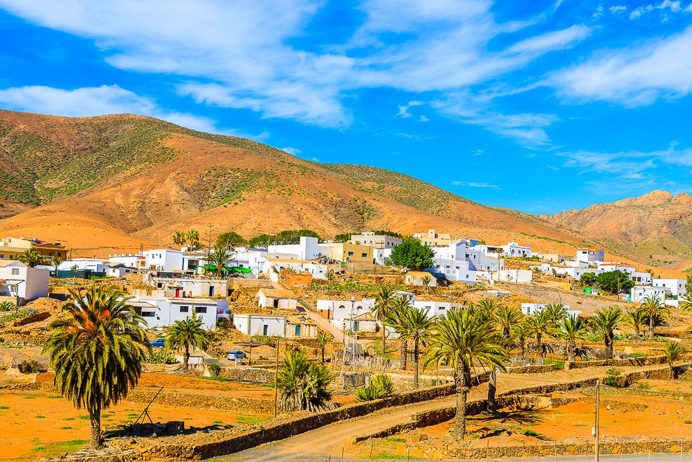
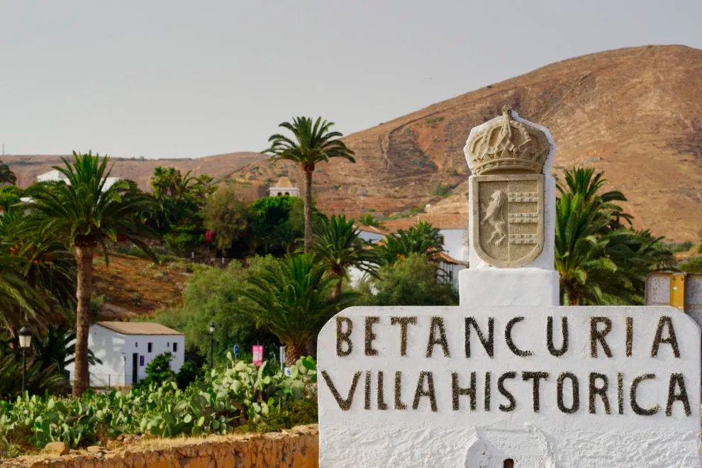
The streets and houses of Betancuria are six hundred years old - which is impressive in itself - and most of the city is located in Betancuria Park ("Parque Rural de Betancuria"). This landscape park measures 16,000 hectares and is characterized by rocky mountain ranges, gorges, cliffs and boulders. Betancuria was Fuerteventura's first settlement; it seems to reign over a scenic paradise. The powerful effect that Betancuria has on its visitors can be felt with all the senses: this magnificent picture that opens up before our eyes and shows a perfect composition of mountains, white houses and palm trees; our ears meet a silence that creates great calm in us. Betancuria has its own magic. We can almost physically feel the turmoil the pirates must have caused when they rushed the city in the 15th century when they looted and destroyed the church of Santa Maria.
Before we return to Caleta de Fuste or to Puerto del Rosario where our route ends, two little jewels are waiting for us. The effort is minimal, as both sights are in close proximity to each other and on the same road. We are talking about the two most famous viewpoints of the island: The viewpoint of Guise and Ayose, represented by 4 meters high bronze statues of the monarchs of the kingdoms into which Fuerteventura was divided before the conquest of Bethencourt: the kingdoms of Jandia and Maxorata. The second viewpoint is the Mirador de Morro Velosa. From both you will have an exceptional view over the north of the island and can see the town of Cotillo in the distance. The valley of Betancuria, Mount Tindaya, the city of Antigua and the volcanic cone of the Caldera de Gairia will capture your gaze. That is a lot.
At the end of this route, you can be sure that not many travellers have experienced Fuerteventura as intensively as you did. The completely justified attraction of the beaches of Fuerteventura has the consequence that many travellers do not explore the interior of the island. We are proud that you also could enjoy the less-known side of the Canary Island. You did your part, now you have miles of sand, beach and sea still to go.
There is no shortage of beaches. This is sure.





Canary Islands

Last routes
Los Rodeos (Airport) - Los Gigantes Cliffs
We make it easy for you. And not only that. Truth be told, the first part of your route on Tenerife is going to be SO easy. And comfortable; without narrow serpentine roads (we will add some later on this route, so we won’t end up bored) It’s up to you whether you want to complete this beautiful route within one day or split it up in two days.
We would like to point out that it’s a challenging route if you drive it within one day.
Nevertheless, if you bring with you the energy and happiness for a longer excursion and if you arrive early in the morning on the island, you will enjoy this trip.
After arrival at Tenerife North Los Rodeos Airport, Rent a car on Tenerife with Hertz or Thrifty, if you haven’t already done so, and enjoy your vacation on the island from the first minute on.
The route has a total distance of approximately 170Km. One way. You then have several options for the return journey to the north of the island.
From the airport, we take the TF-24 road and start our tour.
From Arrecife to Timanfaya National Park. Southwest Route on Lanzarote
An island tour by car is great fun. Compared with the other islands of the Canary Archipelago Lanzarote is not too big and can easily be explored by car. The advantages are obvious: short distances and many possible stations to visit.
Today we would like to propose to you an easy and beautiful round trip by car. There are different points of departure. We can start from Arrecife or from Puerto del Carmen which has a wide range of hotel accommodations for travellers. Another option would be to start from the airport directly after your arrival at Lanzarote. The only requirement is to begin the excursion in the morning; without having to get up particularly early.
Assuming that you already got your Rent a Car in Lanzarte Airport with Hertz, Thrifty or with Dollar, we are glad to see that you are ready to explore and experience Lanzarote.
Our southwest route covers a distance of 80 km. The route is even shorter if you start from Puerto del Carmen or from the airport. However, we depart from Arrecife. From there we take the LZ-2 and then drive onto the LZ-501.
La Palma - Roque de los Muchachos (and the sky)
When visiting La Palma, you will immediately notice that you are entering a green paradise. It does not matter which itinerary you choose, you will witness the incomparable lush vegetation that stands out across the island. Laurel forests overgrow the entire island wherever possible: on slopes, in valleys and gorges.
The forests of La Palma are awesome. You should not only admire them with your eyes, but also experience them olfactorily. Smell them!
Above the island opens up a sky, which, thanks to its clarity, creates optimal conditions for astronomical observation. It is not surprising that Roque de los Muchachos houses the best astrophysical observatory in the northern hemisphere.
La Isla Bonita, the beautiful island. This name is justified. Finally, the world biosphere reserve is located on La Palma.
If you are planning a car route on La Palma, you have several options. The road network is star shaped from the capital. Similar to the road network in Mallorca.
For our today’s route, we decided to propose you a north route, along the LP-1. Our way back to Santa Cruz de La Palma we will then take the northeast highway LP-4. In total, we will run around 150 kilometres. That is not a very long stretch. We do not want to highlight any village specially on this route, telling you that this one is more worth visiting than any other is. Each village has its own charm. It is up to you to decide where to stop, and which places attract you most. Nevertheless, as always, there are many sights on our route, which we will propose to you. There is a lot to discover on La Palma.
So take your Rent a Car La Palma Airport at the Hertz or Thrifty counter. When renting the vehicle, it is worth taking a moment to choose the rental car you feel most comfortable with. We will spend a few hours in it. Then we start our route, and drive on the LP-1.